![]()


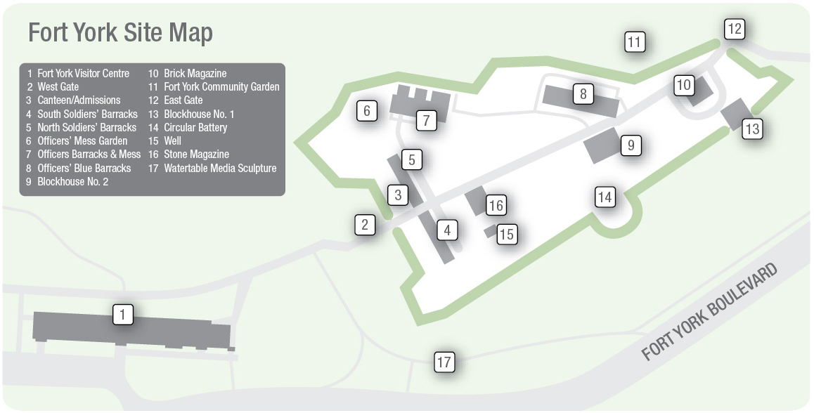
Fort York Community Garden
 In partnership with community members and program partners, Evergreen, a national charity that makes cities more livable, has created a number of community gardens across Toronto. The gardens weave together urban habitat restoration, food gardening, art, and community development to help people to celebrate the special places where they live, work, and play.
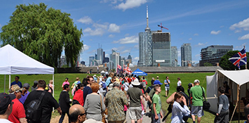
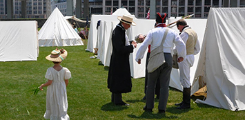
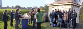
The Fort York Community Garden was established in April of 2008 as a result of a three-year Walmart-Evergreen Green Grant and matching Trillium Foundation grant awarded to The Friends of Fort York. With their location just north of the north ramparts of the fort proper, within the 18 ha Fort York National Historic site, the Community Garden plots are a tangible connection between the fort and people in the neighbourhood. Membership in the community garden is intended for Toronto residents living within 3 km of the garden with no other access to planting facilities. The garden currently contains 21 raised beds of varying sizes that are further divided to create 38 gardening spaces. To reflect the diverse nature of the Fort York neighbourhood, some spaces are assigned to individuals, some belong to community groups such as Sketch and the Harbourfront Community Center, and some plots are designated "communal" for the sharing of culinary and medicinal herbs among the gardeners. At the close of 2011, membership stands at 83, including 32 children enrolled at the nearby City Kids Daycare, and the waiting list include 25 names.
During the formative years, coordination of the gardening spaces, the supply of materials, and instructive workshops were provided by the Evergreen Foundation and its staff. In 2011, the garden became self-governed through the creation of a volunteer board that coordinates key aspects such as membership, communication, and finances. The Friends of Fort York again assisted the Fort York Community Garden in 2011 by applying successfully for a second Walmart-Evergreen Green Grant to fund the construction of a handsome new garden shed that will keep tools and other materials accessible and protected from the elements. The grant allowed the gardeners to retain a contractor, who has erected a spacious wooden building whose details echo the buildings within the fort, and thus adds to the cultural landscape of the Fort York National Historic Site. Finishing touches, such as staining the shed to match other buildings within the fort, should be completed by spring 2012.
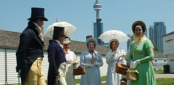
Traditionally, two celebrations are held during the planting season. A community gathering with garden blessing opens the gardening season, and a potluck meal celebrates the harvest. At these events, the joy of growing irresistible and delicious produce is shared among the gardeners, who take pride in their unique location, and enjoy being part of Fort York's outreach efforts. Gardeners have also volunteered their time in the Officers' Mess Kitchen Garden established at Fort York in 2010.
The garden is accessible during the hours that the Fort York National Historic Site is open. To keep abreast of what is going on in the garden, including favourite recipes developed for the use of garden produce, please visit the Fort York Community Garden blog written by Patrisha Robertson. Questions about the garden, or about membership in the Garden Group, please write This email address is being protected from spambots. You need JavaScript enabled to view it..
![]()
![]()
Exhibits
 |
|
|
Fort York – Birthplace of a City is a seven-minute, narrated audio/visual presentation which provides a compelling synopsis of Fort York’s history and in particular the War of 1812 and Battle of York fought on 27 April 1813. It’s a complementary presentation to the panel exhibit. The entire orientation presentation occupies the centre room of North Soldiers’ Barracks, built 1815. |
|
|
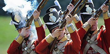
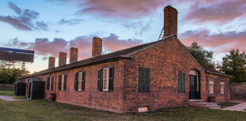
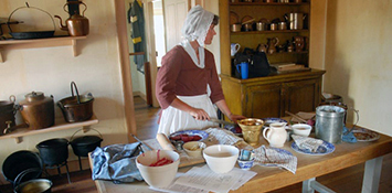
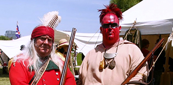
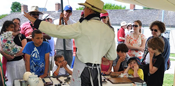
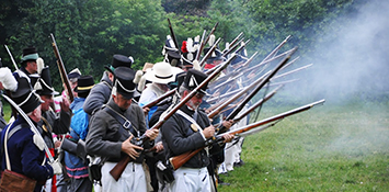
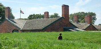
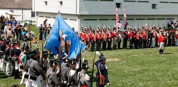
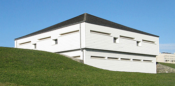
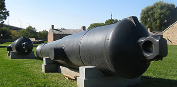
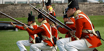
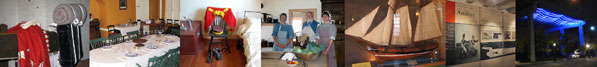
The Soldiers' Barrack Room–1815 (Map reference #5): Officers' Mess Kitchen Garden–1815 (Map reference #6): It is modelled on gardens used by the military to supply fresh produce to the men in garrison. The heirloom vegetables and sweet herbs are grown using organic gardening principles and are used to enhance the Food History Programme at Fort York and special events such as the Conscious Food Festival and the recent Georgian Mess fundraising dinner in honour of Major General Isaac Brock. Volunteers have planted the garden and helped to maintain it since 2010, under the direction of senior program officer Bridget Wranich, so that another dimension of garrison life can be interpreted at the fort. To read more about the garden, please consult the Winter 2010 issue of The Fife and Drum (Volume 14, No.4). (Recreated Environment) The Officers’ Brick Barracks and Mess Establishment (Map reference #7): 1815 Kitchen and Archaeology Exhibit (Map reference #7): Archaeology: The Search for History Beneath our Feet (Map reference #8): Fort Toronto 1750–59 and The Fur Trade (Map reference #8): War on the Lakes (Map reference #8): HMS Nancy Display Case (Map reference #8): The Soldier's Trade – Exhibit: 1793–1870 (Map reference #9): The exhibit is a rich and graphic presentation of original and reproduction military objects which include uniforms, weapons, headgear, artillery, tools, musical instruments, and archaeological material. Large scale dioramas show the fort and associated defences in relation to the Town of York (Toronto) and its position on Toronto Bay as the city’s primary harbour defence. Featured objects include two large cannon used by York’s defenders during the Battle of York on 27 April 1813. One is an extremely rare form of British ordnance cast in between 1656–58 for the army of Oliver Cromwell. It is one of only two known to exist. The Soldier's Trade occupies the upper and lower floors of Blockhouse Number 2, built in 1813 as a 160-man barracks and fortified structure. It was among the first army buildings to be constructed after the American attack on York. Watertable (Map reference #17): Due to on-site construction, the 'Watertable' exhibit has been temporarily removed. |
|
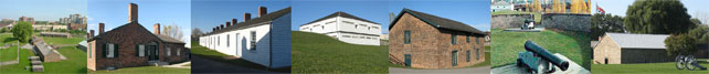
Structures
 |
|
|
Officers' Brick Barracks & Mess Establishment (Map reference #7): |
|
|
Blue Barracks & Mess (Map reference #8): Blockhouse No. 1 & No. 2 (Map reference #13 & #9): |
|
Subcategories
- Joe Gill inspired and led The Friends over 25 years, helping preserve and revitalize Fort York during a time of massive change.
- George Crookshank chest donated to City of Toronto
- Relics of the Rebellion of 1837: the money vaults at Fort York
- Fort York Guard on Pause in 2022
- New Museum Administrator of Fort York National Historic Site

- Further Event Information & Latest Updates
For further information and last minute...